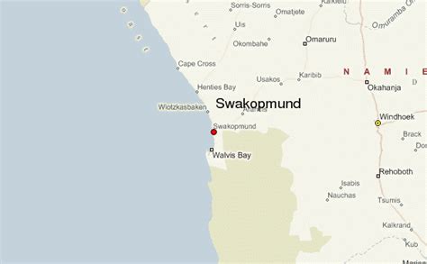
Location: Swakopmund 🌎
Location: Swakopmund, Namibia
Administration Region: Erongo
Population: 34300
ISO2 Code: Erongo
ISO3 Code: NAM
Location Type: First-level Admin Capital
Latitude: -22.6833
Longitude: 14.5333
Swakopmund (English: “Mouth of the Swakop”) is a city on the coast of western Namibia, 352 km (219 mi) west of the Namibian capital Windhoek via the B2 main road. It is the capital of the Erongo administrative district. As of 2011, the town has 44,725 inhabitants and covers 196 km2 (76 sq mi) of land.The city is situated at the edge of the Namib Desert and is the fourth largest population centre in Namibia. Swakopmund is a beach resort and an example of German colonial architecture. It was founded in 1892 as the main harbour for German South West Africa.
Buildings in the city include the Altes Gefängnis, a prison designed by Heinrich Bause in 1909. The Woermannhaus, built in 1906 with a prominent tower (Damara tower), is now a public library. Attractions in Swakopmund include a Swakopmund Museum, the National Marine Aquarium of Namibia, a crystal gallery, and spectacular sand dunes near Langstrand south of the Swakop River. Outside the city, the Rossmund Desert Golf Course is one of only five all-grass desert golf courses in the world. Nearby is a farm that offers camel rides to tourists and the Martin Luther steam locomotive, dating from 1896 and abandoned in the desert.

Top Swakopmund HD Maps, Free Download 🗺️
Map
Maps
United States
United States
World Map
China
China