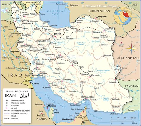
Location: Abarkūh 🌎
Location: Abarkūh, Iran
Administration Region: Yazd
Population: 27524
ISO2 Code: Yazd
ISO3 Code: IRN
Location Type: Lower-level Admin Capital
Latitude: 31.1267
Longitude: 53.2592
Abarkuh (Persian: ابركوه, also Romanized as Abarkūh and Abar Kūh; also known as Abarghoo, Abarkū, Abar Qū, and Abarqūh) is a city in the Central District of Abarkuh County, Yazd province, Iran, and serves as capital of the county.
At the 2006 census, its population was 20,994 in 5,880 households. The following census in 2011 counted 23,986 people in 7,039 households. The latest census in 2016 showed a population of 27,524 people in 8,489 households.Abarkuh is located at an altitude of 1510 metres (4954 feet). An ancient living cypress tree, the Sarv-e-Abarqu, is located here.Abarkooh has 4 adobe ice houses which date back to Qajar dynasty. Adobe ice houses (yakhchāl) are ancient buildings used to store ice and food throughout the year, commonly used prior to the invention of the refrigerator in the past.

Top Abarkūh HD Maps, Free Download 🗺️
Map
Maps
United States
United States
World Map
China
China
