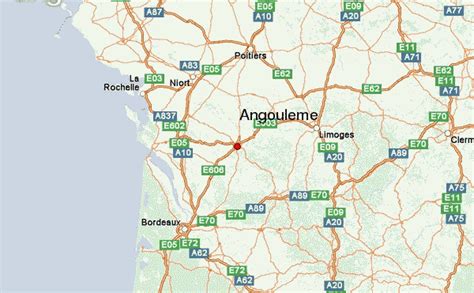
Angoulême (French pronunciation: [ɑ̃ɡulɛːm] ; Poitevin-Saintongeais: Engoulaeme; Occitan: Engoleime) is small city in the southwestern French department of Charente, of which it is the prefecture.
The inhabitants of the commune are known as Angoumoisins or Angoumoisines.Located on a plateau overlooking a meander of the river Charente, the city is nicknamed the “balcony of the southwest”. The city proper’s population is a little less than 42,000 but it is the centre of an urban area of 110,000 people extending more than fifteen kilometres (9.3 miles) from east to west.
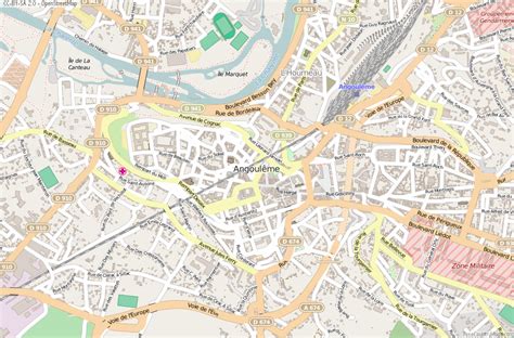
Formerly the capital of Angoumois in the Ancien Régime, Angoulême was a fortified town for a long time, and was highly coveted due to its position at the centre of many roads important to communication, so therefore it suffered many sieges. From its tumultuous past, the city, perched on a rocky spur, inherited a large historical, religious, and urban heritage which attracts a lot of tourists.
Nowadays, Angoulême is at the centre of an agglomeration, which is one of the most industrialised regions between Loire and Garonne (the paper industry was established in the 16th century, a foundry and electromechanical engineering developed more recently). It is also a commercial and administrative city with its own university of technology, and a vibrant cultural life. This life is dominated by the Angoulême International Comics Festival, the FFA Angoulême Francophone Film Festival and the Musiques Métisses Festival that contribute substantially to the international renown of the city. Moreover, Angoulême hosts 40 animation and video game studios that produce half of France’s animated production. Wes Anderson’s The French Dispatch was filmed in this city.
Angoulême is called “Ville de l’Image” which means literally “City of the Image”. The commune has been awarded four flowers by the National Council of Towns and Villages in Bloom in the Competition of cities and villages in Bloom.