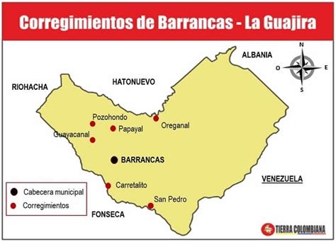
Location: Barrancas 🌎
Location: Barrancas, Colombia
Administration Region: La Guajira
Population: 38232
ISO2 Code: La Guajira
ISO3 Code: COL
Location Type: Lower-level Admin Capital
Latitude: 11
Longitude: -72.75
Barrancas is a town and municipality of the Colombian Department of La Guajira. The municipality of Barrancas is located to the left margin of the Ranchería River in a valley formed between the Sierra Nevada de Santa Marta mountains and the Serranía del Perijá. Barrancas has a total area of 742 km2 and at 40 meters over sea level. The average temperature is 28 °C throughout the year and distances from the capital of the Department of La Guajira, Riohacha. It became a municipality in 1892.Its economy is based on agriculture and coal mining which is exploited by the Cerrejón coal mine.
Top Barrancas HD Maps, Free Download 🗺️
Map
Maps
United States
United States
World Map
China
China
