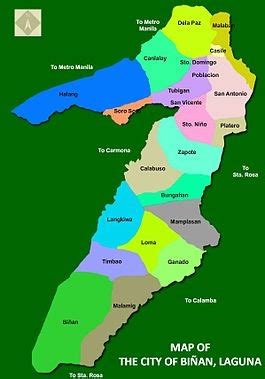
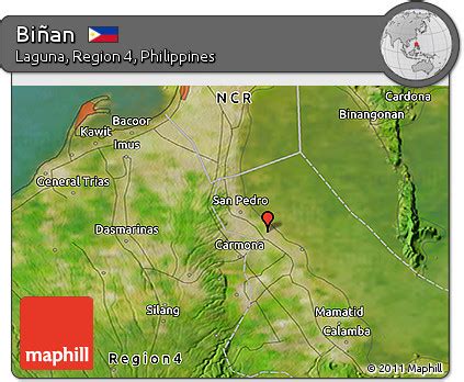
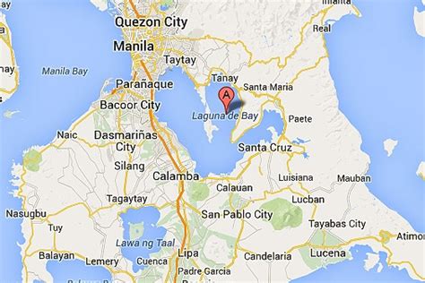
Biñan (IPA: [biˈɲan]), officially the City of Biñan (Filipino: Lungsod ng Biñan), is a 1st class component city in the province of Laguna, Philippines. According to the 2020 census, it has a population of 407,437 people. Biñan, also known as Biniang, has become both a suburban residential community of Metro Manila and a location for some of the Philippines’ largest industrial estates and export processing zones. Prior to its cityhood in 2010, Biñan was the richest municipality in the Philippines with an annual gross income of ₱677 million (US$14.383 million) and net income of ₱250 million (US$5.308 million), as of 2007 by the Commission On Audit. According to the 2020 census, it has a population of 407,437, making it the third largest in population in the province of Laguna, after Calamba and Santa Rosa. By virtue of Republic Act 10658, signed on March 27, 2015, by President Benigno Aquino III, Biñan has been separated from the First Congressional District of Laguna and formed the Lone Congressional District of Biñan. The first representative, the former mayor of the city, has been elected during the 2016 elections, unopposed.