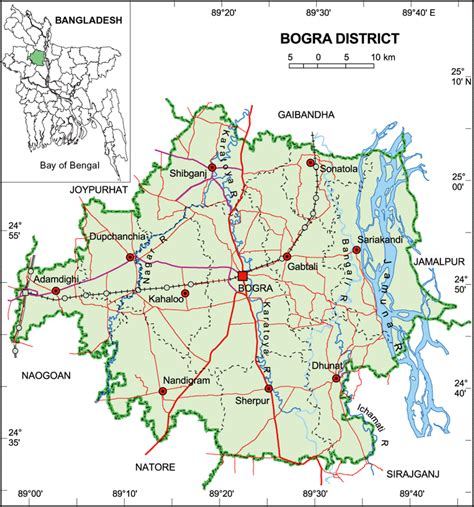
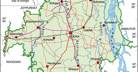
Bogra (Bengali: বগুড়া), officially known as Bogura, is a major city located in Bogra District, Rajshahi Division, Bangladesh. The city is a major commercial hub in Northern Bangladesh. It is the second largest city in Rajshahi Division with a population of over 3.7 million. The Bogra bridge connects the Rajshahi Division and Rangpur Division.Bogra is named after Nasiruddin Bughra Khan, the Governor of Bengal from 1279 to 1282 and the son of Delhi Sultan Ghiyasuddin Balban. The city is approximately 71.56 km2 (27.63 sq mi) and is divided into 21 wards. Bogra has a population of around 12,40,000 people. Since it is one of the oldest cities in Bengal, Bogra is famous for its many ancient Buddhist stupas, Hindu temples, and ancient palaces of Buddhist kings and Muslim sultans.
The city has produced notable personalities including Prime Minister Muhammad Ali Bogra of Pakistan, President Ziaur Rahman of Bangladesh, both of whom were born and lived in the city.