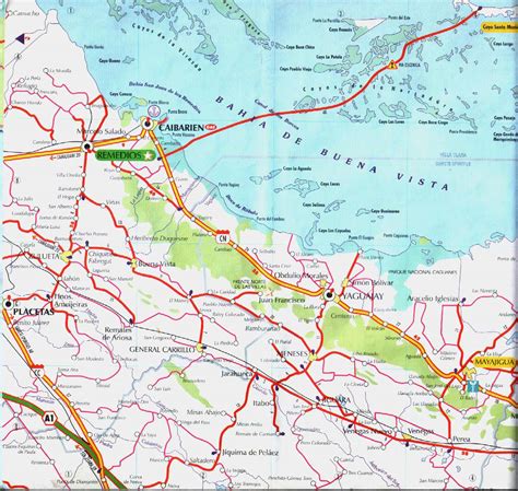
Location: Caibarién, Cuba
Administration Region: Villa Clara
Population: 38479
ISO2 Code: Villa Clara
ISO3 Code: CUB
Location Type: Lower-level Admin Capital
Latitude: 22.5158
Longitude: -79.4722
Caibarién is a municipality city in the Villa Clara province of Cuba.
Caibarién is known as “La Villa Blanca” (lit. ’The White Town’) for its sands and beaches. They are famous for their “Parrandas” (Carnivals) along with Remedios (the neighboring town located 7 kilometres (4.3 mi) west) and Camajuani.
Top Caibarién HD Maps, Free Download 🗺️
Map
Maps
United States
United States
World Map
China
China
Cayo Ensenachos, Varadero Beach Cuba, Caibarien Of, Caibarién, Cuba