Location: Chattogram 🌎
Location: Chattogram, Bangladesh
Administration Region: Chattogram
Population: 7000000
ISO2 Code: Chattogram
ISO3 Code: BGD
Location Type: First-level Admin Capital
Latitude: 22.335
Longitude: 91.8325
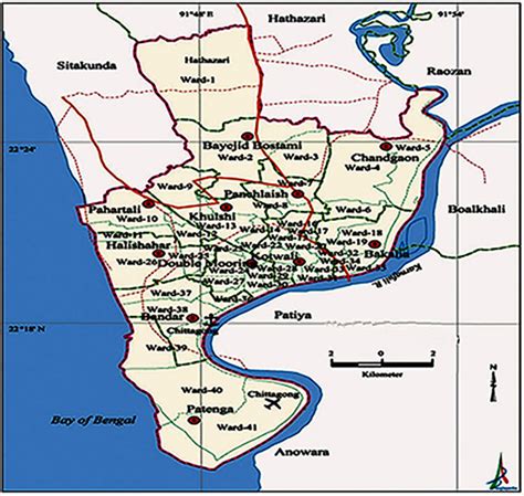
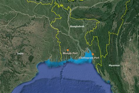
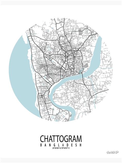
Chittagong ( CHIT-ə-gong), officially Chattogram (Bengali: চট্টগ্রাম), is the second-largest city in Bangladesh after Dhaka and third largest city in Bengal region. It is the administrative seat of the eponymous division and district. It hosts the busiest seaport on the Bay of Bengal. The city is located on the banks of the Karnaphuli River between the Chittagong Hill Tracts and the Bay of Bengal. The Greater Chittagong Area had a population of more than 5.2 million in 2022. In 2020, the city area had a population of more than 3.9 million.One of the world’s oldest ports with a functional natural harbor for centuries, Chittagong appeared on ancient Greek and Roman maps, including on Ptolemy’s world map. It was located on the southern branch of the Silk Road. In the 9th century, merchants from the Abbasid Caliphate established a trading post in Chittagong. The port fell to the Muslim conquest of Bengal during the 14th century. It was the site of a royal mint under the Delhi Sultanate, Bengal Sultanate and Mughal Empire. Between the 15th and 17th centuries, Chittagong was also a center of administrative, literary, commercial and maritime activities in Arakan, a narrow strip of land along the eastern coast of the Bay of Bengal which was under strong Bengali influence for 350 years. During the 16th century, the port became a Portuguese trading post and João de Barros described it as “the most famous and wealthy city of the Kingdom of Bengal”. The Mughal Empire expelled the Portuguese and Arakanese in 1666.
Like the rest of Bengal British East India Company took control of the city in 1793. The Port of Chittagong was re-organized in 1887 and its busiest shipping links were with British Burma. In 1928, Chittagong was declared a “Major Port” of British India. During World War II, Chittagong was a base for Allied Forces engaged in the Burma Campaign. The port city began to expand and industrialize during the 1940s, particularly after the Partition of British India. The city was the historic terminus of the Assam Bengal Railway and Pakistan Eastern Railway. During the Bangladesh Liberation War in 1971, Chittagong was the site of the Bangladeshi declaration of independence. The port city has benefited from the growth of heavy industry, logistics, and manufacturing in Bangladesh. Trade unionism was strong during the 1990s.
Chittagong accounts for 12% of Bangladesh’s GDP, including 40% of industrial output, 80% of international trade, and 50% of tax revenue. The port city is home to many of the oldest and largest companies in the country. The Port of Chittagong is one of the busiest ports in South Asia. The largest base of the Bangladesh Navy is located in Chittagong, along with an air base of the Bangladesh Air Force, garrisons of the Bangladesh Army and the main base of the Bangladesh Coast Guard. The eastern zone of the Bangladesh Railway is based in Chittagong. The Chittagong Stock Exchange is one of the twin stock markets of Bangladesh with over 700 listed companies. The Chittagong Tea Auction is a commodity exchange dealing with Bangladeshi tea. The CEPZ and KEPZ are key industrial zones with foreign direct investments. The city is served by Shah Amanat International Airport for domestic and external flights. Chittagong has a high degree of religious and ethnic diversity among Bangladeshi cities, despite having a great Bengali Muslim majority. Minorities include Bengali Hindus, Bengali Christians, Bengali Buddhists, Chakmas, Marmas, Tripuris, Garos and others.

Top Chattogram HD Maps, Free Download 🗺️
Map
Maps
United States
United States
World Map
China
China


