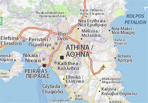
Holargos (Greek: Χολαργός, also: Cholargos) is a town and a suburb of the Athens urban area, Greece, located northeast of the Athens city center and about 6 kilometers (3.7 miles) away from Syntagma Square. Since the 2011 local government reform it is part of the municipality Papagou-Cholargos, of which it is the seat and a municipal unit. The municipal unit has an area of 3.950 km2. The main thoroughfare is Mesogeion Avenue, which connects Cholargos with central Athens and the northern beltway Motorway 6.
Cholargos was the name of a deme of ancient Attica. The most prominent citizen of ancient Cholargos was Pericles. Cholargos was part of the community of Chalandri until 1933, when it became a separate community. It became a municipality in 1963.