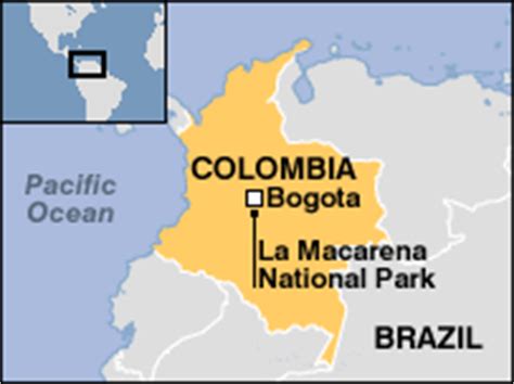
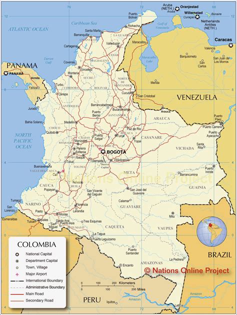
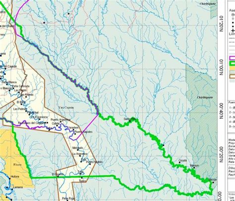
Colombia ( , ; Spanish: [koˈlombja] ), officially the Republic of Colombia, is a country mostly in South America with insular regions in North America. The Colombian mainland is bordered by the Caribbean Sea to the north, Venezuela to the east and northeast, Brazil to the southeast, Ecuador and Peru to the south and southwest, the Pacific Ocean to the west, and Panama to the northwest. Colombia is divided into 32 departments. The Capital District of Bogotá is also the country’s largest city hosting the main financial and cultural hub, and other major urbes include Medellín, Cali, Barranquilla, Cartagena, Santa Marta, Cúcuta, Ibagué, Villavicencio and Bucaramanga. It covers an area of 1,141,748 square kilometers (440,831 sq mi), and has a population of around 52 million. Colombia is the largest Spanish-speaking country in South America. Its cultural heritage—including language, religion, cuisine, and art—reflects its history as a colony, fusing cultural elements brought by immigration from Europe and the Middle East, with those brought by the African diaspora, as well as with those of the various Indigenous civilizations that predate colonization. Spanish is the Official language, although English and 64 other languages are recognized regionally.
Colombia has been home to many indigenous peoples and cultures since at least 12,000 BCE. The Spanish first landed in La Guajira in 1499, and by the mid-16th century they had colonized much of present-day Colombia, and established the New Kingdom of Granada, with Santa Fé de Bogotá as its capital. Independence from the Spanish Empire was achieved in 1819, with what is now Colombia emerging as the United Provinces of New Granada. The new polity experimented with federalism as the Granadine Confederation (1858) and then the United States of Colombia (1863), before becoming a republic—the current Republic of Colombia—in 1886. With the backing of the United States and France, Panama seceded from Colombia in 1903, resulting in Colombia’s present borders. Beginning in the 1960s, the country has suffered from an asymmetric low-intensity armed conflict and political violence, both of which escalated in the 1990s. Since 2005, there has been significant improvement in security, stability and rule of law, as well as unprecedented economic growth and development. Colombia is recognized for its health system, being the best healthcare in the Americas according to The World Health Organization and 22nd on the planet, In 2022, 26 Colombian hospitals were among the 61 best in Latin America (42% total). Also in 2023, two Colombian hospitals were among the Top 75 of the world.Colombia is one of the world’s seventeen megadiverse countries; it has the second-highest level of biodiversity in the world. Its territory encompasses Amazon rainforest, highlands, grasslands and deserts. It is the only country in South America with coastlines (and islands) along both the Atlantic and Pacific oceans. Colombia is a key member of major global and regional organizations including the UN, the WTO, the OECD, the OAS, the Pacific Alliance and the Andean Community; it is also a NATO Global Partner. Its diversified economy is the third-largest in South America, with macroeconomic stability and favorable long-term growth prospects.