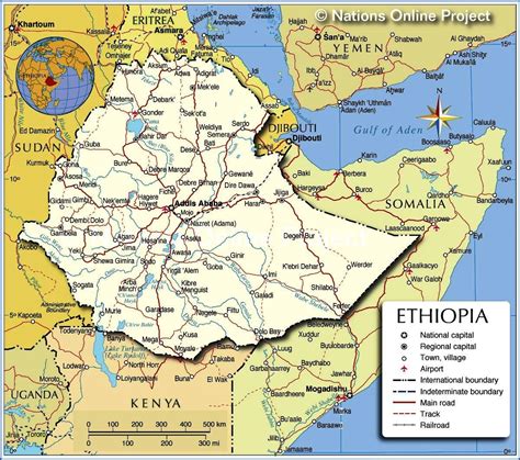
Location: Degeh Bur 🌎
Location: Degeh Bur, Ethiopia
Administration Region: Sumalē
Population: 30027
ISO2 Code: Sumalē
ISO3 Code: ETH
Location Type:
Latitude: 8.2167
Longitude: 43.5667
Degehabur (Somali: Dhagaxbuur, Amharic: ደገሕ ቡር) is a town in the Somali Region of Ethiopia. It is located in the Jarar Zone of the Somali Region. Degahabur is occupied by the by the Rer Isaaq ,Ogaden. Degehabur sits at 1044 meters above sea level. The town is the administrative center of Degehabur woreda.
The Degehabur consist of 11 district and the oldest one is the Aware district, others are Yo’ale, Gashamo, Gunagado, Dig, Bir,Ilbur etc.
Local landmarks include the Church of St. George, and the white mosque of Degehabur, which Anthony Mockler described as “the most important in the Somali Region.” The NGO Doctors without Borders operates a clinic in Degehabur. The upgrade of the 165-kilometer road between Degahabur and the Regional capital, Jijiga, to an all-weather asphalt road was announced to be almost complete 31 October 2007, with the remaining 40 kilometers awaiting completion. Construction of a 106-kilometer asphalt road between Degehabur and the town of Shekoosh was underway by March 2009. Local inhabitants constitute half of the 1,100 workers employed by the project.

Top Degeh Bur HD Maps, Free Download 🗺️
Map
Maps
United States
United States
World Map
China
China