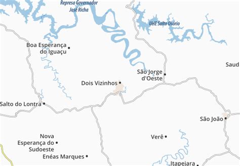
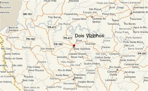
Dois Vizinhos (“Two Neighbours” in English) gained its municipality on November 28, 1961. It is a Brazilian municipality in the southwestern state of Paraná, situated in the southwestern mesoregion of the state and in the microregion of Francisco Beltrão. It is at an average altitude of 509 meters in relation to sea level. Its main accesses are by highways PR-281, PR-473 and PR-493. Its population, according to the 2020 estimate of IBGE, was of 41,038 inhabitants.
In 2005, the municipality won the title of National Capital of Chicken.
Dois Vizinhos has a population of approximately 40,000 people, of whom the major part lives in the city. The economy is mainly based on agriculture, turkey and chicken processing and export, and an ascending computer industry named CISS. It is the birthplace of the footballer Dagoberto who plays as a forward.