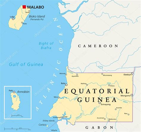
Equatorial Guinea (Spanish: Guinea Ecuatorial; French: Guinée équatoriale; Portuguese: Guiné Equatorial), also rarely known as Equatoguinea, officially the Republic of Equatorial Guinea (Spanish: República de Guinea Ecuatorial, French: République de Guinée équatoriale, Portuguese: República da Guiné Equatorial), is a country on the west coast of Central Africa, with an area of 28,000 square kilometres (11,000 sq mi). Formerly the colony of Spanish Guinea, its post-independence name refers to its location near both the Equator and in the African region of Guinea. As of 2021, the country had a population of 1,468,777, over 85% of whom are ethnically Fang.
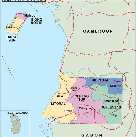
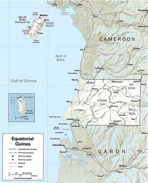
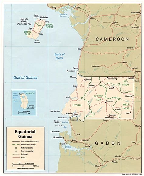
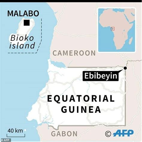
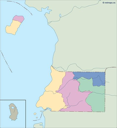
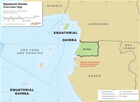
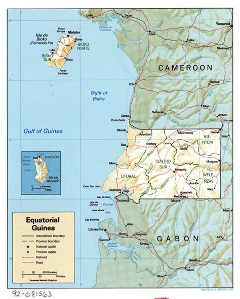
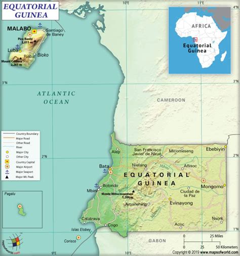
Equatorial Guinea consists of two parts, an insular and a mainland region. The insular region consists of the islands of Bioko (formerly Fernando Pó) in the Gulf of Guinea and Annobón, a small volcanic island which is the only part of the country south of the equator. Bioko Island is the northernmost part of Equatorial Guinea and is the site of the country’s capital, Malabo. The Portuguese-speaking island nation of São Tomé and Príncipe is located between Bioko and Annobón. The mainland region, Río Muni, is bordered by Cameroon on the north and Gabon on the south and east. It is the location of Bata, Equatorial Guinea’s largest city, and Ciudad de la Paz, the country’s planned future capital. Rio Muni also includes several small offshore islands, such as Corisco, Elobey Grande, and Elobey Chico. The country is a member of the African Union, Francophonie, OPEC and the CPLP.
After becoming independent from Spain in 1968, Equatorial Guinea was ruled by President for life Francisco Macías Nguema until he was overthrown in a coup in 1979 by his nephew Teodoro Obiang Nguema Mbasogo who has served as the country’s president since. Both presidents have been widely characterized as dictators by foreign observers. Since the mid-1990s, Equatorial Guinea has become one of sub-Saharan Africa’s largest oil producers. It has subsequently become the richest country per capita in Africa, and its gross domestic product (GDP) adjusted for purchasing power parity (PPP) per capita ranks 43rd in the world; however, the wealth is distributed extremely unevenly, with few people benefiting from the oil riches. The country ranks 144th on the 2019 Human Development Index, with less than half the population having access to clean drinking water and 7.9% of children dying before the age of five.As a former Spanish colony, the country maintains Spanish as its official language alongside French and (as of 2010) Portuguese, being the only African country (aside from the largely unrecognized Sahrawi Arab Democratic Republic) where Spanish is an official language. It is also the most widely spoken language (considerably more than the other two official languages); according to the Instituto Cervantes, 87.7% of the population has a good command of Spanish. The Fang people are the country’s dominant ethnic group, comprising more than 85% of the population. The Bubi people, indigenous to Bioko are the second largest group at approximately 6.5% of the population.
Equatorial Guinea’s government is authoritarian and has one of the worst human rights records in the world, consistently ranking among the “worst of the worst” in Freedom House’s annual survey of political and civil rights. Reporters Without Borders ranks Obiang among its “predators” of press freedom. Human trafficking is a significant problem, with the U.S. Trafficking in Persons Report identifying Equatorial Guinea as a source and destination country for forced labour and sex trafficking. The report also noted that Equatorial Guinea “does not fully meet the minimum standards for the elimination of trafficking but is making significant efforts to do so.”