Location: Gallipoli 🌎
Location: Gallipoli, Turkey
Administration Region: Çanakkale
Population: 31782
ISO2 Code: Çanakkale
ISO3 Code: TUR
Location Type: Lower-level Admin Capital
Latitude: 40.35
Longitude: 26.45
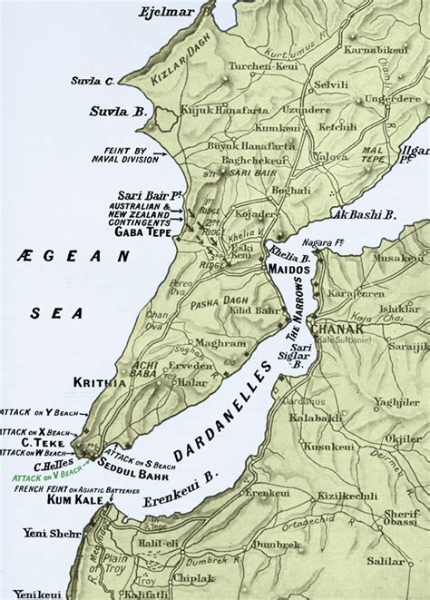
The Gallipoli peninsula (; Turkish: Gelibolu Yarımadası; Greek: Χερσόνησος της Καλλίπολης, romanized: Chersónisos tis Kallípolis) is located in the southern part of East Thrace, the European part of Turkey, with the Aegean Sea to the west and the Dardanelles strait to the east.
Gallipoli is the Italian form of the Greek name Καλλίπολις (Kallípolis), meaning ‘beautiful city’, the original name of the modern town of Gelibolu. In antiquity, the peninsula was known as the Thracian Chersonese (Ancient Greek: Θρακικὴ Χερσόνησος, romanized: Thrakiké Chersónesos; Latin: Chersonesus Thracica).
The peninsula runs in a south-westerly direction into the Aegean Sea, between the Dardanelles (formerly known as the Hellespont), and the Gulf of Saros (formerly the bay of Melas). In antiquity, it was protected by the Long Wall, a defensive structure built across the narrowest part of the peninsula near the ancient city of Agora. The isthmus traversed by the wall was only 36 stadia in breadth or about 6.5 km (4.0 mi), but the length of the peninsula from this wall to its southern extremity, Cape Mastusia, was 420 stadia or about 77.5 km (48.2 mi).
Top Gallipoli HD Maps, Free Download 🗺️
Map
Maps
United States
United States
World Map
China
China


