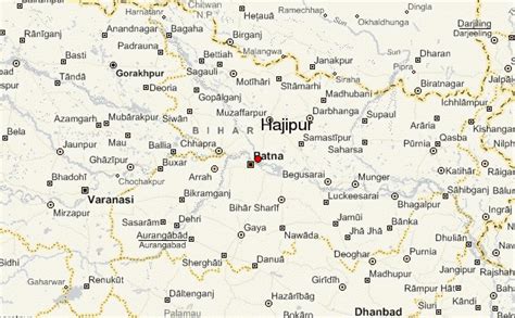
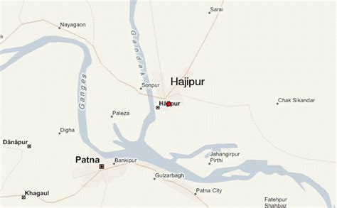
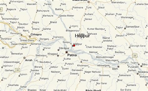
Hajipur (, Hindi: [‘ɦaːdʒiːpʊr] ) is the headquarters and largest city of Vaishali district of the state of Bihar in India. Hajipur is the 16th most populous city of Bihar, besides being the second-fastest developing city, next to Patna. It had a total population of 1.47 lakh as per census 2011. Vaishali district is ranked 8th among 38 districts in Bihar in terms of growth.The city is known for cultivating Bananas. Patna, is only 10 km (6.2 mi) from Hajipur, with the cities separated by the Ganges river. The metropolitan region of Patna comprises the Patna Regional Development Authority (PRDA) area includes Hajipur under Bihar Urban Infrastructure Development Corporation. Mahatma Gandhi Setu, one of the longest bridges in the world at 5.75 kilometres (3.57 mi) links Hajipur to Patna. After Patna, it is the fastest-developing city in Bihar, primarily because of its proximity to Patna. Hajipur lies on the north bank of the Ganga while Patna lies on the south, the Gandhi Setu bridge connects both cities. Another bridge, the Digha–Sonpur Bridge, which crosses the Ganga north-west of Patna, narrows the distance between Hajipur and Patna. There have been plans to expand Patna to Greater Patna, which would entail absorbing Hajipur and other surrounding towns.The area of Hajipur city is spread across 19.64 km2 (7.58 sq mi). The city is divided into 39 Wards. Hajipur is the only twin city of Patna and lies nearest to the capital and shares most of its government works, headquarters, educational institutions. Being another district headquarters, it is equal to the capital in terms of powers.