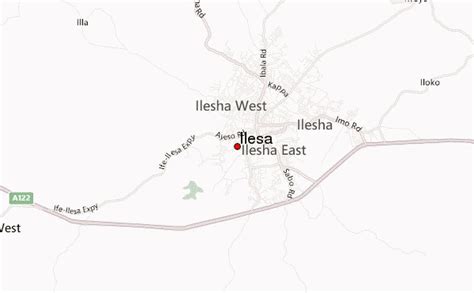
Ilesa (Yoruba: Iléṣà) is an ancient town located in the Osun State, southwest Nigeria; it is also the name of a historic kingdom (also known as Ijesha) centred on that town. The state is ruled by a monarch bearing the title of the Owa Obokun Adimula of Ijesaland. The state of Ilesa consisted of Ilesa itself and a number of smaller surrounding cities.The Ijesa, a term also denoting the people of the state of Ilesa, are part of the present Osun State of Nigeria. Some of the popular towns of the Ijesa are Odo-Ijesa, Ilaje, Igbogi, Ise-Ijesa, Ibokun, Erin Ijesa, Ijeda-Ijesa, Ipetu Jesa, Ijebu-Jesa, Esa-Oke,Esa Odo, Ipole Ijesa, Ifewara Ijesa, Ipo Arakeji, Iloko Ijesa, Iwara Ijesa, Iperindo Ijesa, Erinmo Ijesa, Iwaraja Ijesa, Oke-Ana Ijesa, Idominasi, Ilase Ijesa, Igangan ijesa, Imo Ijesa, Alakowe Ijesa, Osu Ijesa, Eti Oni, Itaore, Itagunmodi, Iyinta, Itaapa, Epe Ijesa, Omo Ijesa, Eti-oni, Ibokun, Inila, Ijinla, Iloba Ijesa, Odo Ijesa, Imogbara Ijesa, Eseun Ijesa, Iloo, Owena Ijesa, Ido Ijesa, Ido Oko, Ibala Ijesa, Ere Ijesa, Ilahun, Ibodi, Ijaaregbe, Ikinyinwa, Idominasi, Ilowa, and Ibodi.The state of Ijeshaland was founded c.1300 by Ajibogun Ajaka Owa Obokun Onida Raharaha, a warlike youngest son of Yoruba Projenitor Oduduwa.