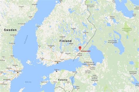
Location: Imatra 🌎
Location: Imatra, Finland
Administration Region: Etelä-Karjala
Population: 27835
ISO2 Code: Etelä-Karjala
ISO3 Code: FIN
Location Type: Lower-level Admin Capital
Latitude: 61.1833
Longitude: 28.7667
Imatra is a town and municipality in southeastern Finland. Imatra is dominated by Lake Saimaa, the Vuoksi River and the border with Russia. On the other side of the border, 7 kilometres (4 mi) away from the centre of Imatra, lies the Russian town of Svetogorsk. St Petersburg is situated 210 km (130 mi) to the southeast, Finland’s capital Helsinki is 230 km (140 mi) away and Lappeenranta, the nearest Finnish town, is 37 km (23 mi) away. Imatra belongs to the administrative province of Southern Finland and the region of South Karelia.
The main employers are pulp and paper manufacturer Stora Enso Oyj, the Town of Imatra, engineering steel manufacturer Ovako Bar Oy Ab, and the Finnish Border Guard.
As of October 2003, the total number of employees was 12,423. As of December 2004, 1,868 employees were employed by the Town of Imatra. The town manager of Imatra is Ari Lindeman. The town’s nicknames include Imis, Ibiza and Nahkalippis City (Leather Baseball Cap City). Because of the location near the border, Russian tourists are a common sight in the town, and Russian tourism greatly benefits the local business life. Most people shop at Imatra, and Imatra’s tax-free sales are the third largest among Finnish cities (only Helsinki and Lappeenranta are ahead).The name of Imatra is believed to have originated from a Pre-Finno-Ugric substrate language. The lightning symbols on Imatra’s coat of arms refer to the power plants that were started to be built in the early 1920s in both Tainionskoski and Imatrankoski rapids. The coat of arms was designed by Olof Eriksson, and the Imatra town council approved it on August 9, 1950. The Ministry of the Interior approved the coat of arms for use on October 25 of the same year.
Top Imatra HD Maps, Free Download 🗺️
Map
Maps
United States
United States
World Map
China
China
