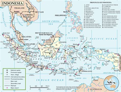
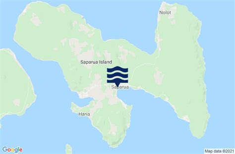
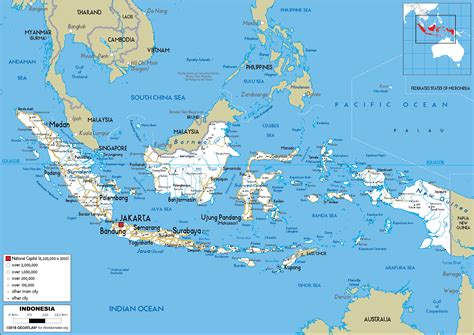
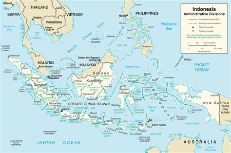
Indonesia, officially the Republic of Indonesia, is a country in Southeast Asia and Oceania between the Indian and Pacific oceans. It consists of over 17,000 islands, including Sumatra, Java, Sulawesi, and parts of Borneo and New Guinea. Indonesia is the world’s largest archipelagic state and the 14th-largest country by area, at 1,904,569 square kilometres (735,358 square miles). With around 280 million people, Indonesia is the world’s fourth-most populous country and the most populous Muslim-majority country. Java, the world’s most populous island, is home to more than half of the country’s population.
As the world’s third largest democracy, Indonesia is a presidential republic with an elected legislature. It has 38 provinces, of which nine have special status. The country’s capital, Jakarta, is the world’s second-most populous urban area. Indonesia shares land borders with Papua New Guinea, East Timor, and the eastern part of Malaysia, as well as maritime borders with Singapore, Vietnam, Thailand, the Philippines, Australia, Palau, and India. Despite its large population and densely populated regions, Indonesia has vast areas of wilderness that support one of the world’s highest level of biodiversity.
The Indonesian archipelago has been a valuable region for trade since at least the seventh century, when the Srivijaya Kingdom formed trade links with China. Indonesian history has been influenced by foreign powers drawn to its natural resources. Under Indian influence, Hindu and Buddhist kingdoms flourished from the early centuries CE. Muslim traders later brought Islam, and European powers fought one another to monopolise trade in the Spice Islands of Maluku during the Age of Discovery. Following three and a half centuries of Dutch colonialism, Indonesia secured its independence after World War II. Indonesia’s history has since been turbulent, with challenges posed by natural disasters, corruption, separatism, a democratisation process, and periods of rapid economic change.
Indonesia consists of thousands of distinct native ethnic and hundreds of linguistic groups, with Javanese being the largest. A shared identity has developed with the motto “Bhinneka Tunggal Ika” (“Unity in Diversity” literally, “many, yet one”), defined by a national language, cultural diversity, religious pluralism within a Muslim-majority population, and a history of colonialism and rebellion against it. The economy of Indonesia is the world’s 16th-largest by nominal GDP and the 7th-largest by PPP. It is a regional power and is considered a middle power in global affairs. The country is a member of several multilateral organisations, including the United Nations, World Trade Organization, G20, and a founding member of the Non-Aligned Movement, Association of Southeast Asian Nations, East Asia Summit, D-8 and the Organisation of Islamic Cooperation.