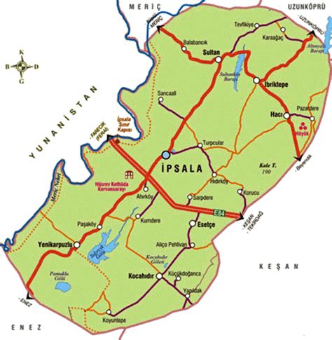
Location: İpsala 🌎
Location: İpsala, Turkey
Administration Region: Edirne
Population: 27498
ISO2 Code: Edirne
ISO3 Code: TUR
Location Type: Lower-level Admin Capital
Latitude: 40.9217
Longitude: 26.3819
İpsala (Ancient Greek: Κύψελα, romanized: Kýpsela; Greek: Ύψαλα, romanized: Ύpsala) is a town in Edirne Province in northwestern Turkey. It is the seat of İpsala District. Its population is 8,546 (2022). It is the location of one of the main border checkpoints between Greece and Turkey. The Greek town opposite İpsala is Kipoi.
The state road D.110 (European route E90) connects the border checkpoint İpsala with Tekirdağ at the coast of Marmara Sea. The town consists of 6 quarters: Kapucu, Saraçilyas, Bayrambey, Köprü, Bozkurt and Fatih.
Top İpsala HD Maps, Free Download 🗺️
Map
Maps
United States
United States
World Map
China
China
