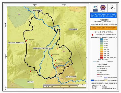
Jaral del Progreso is a Mexican city and municipality located in the Bajío (lowlands) of the state of Guanajuato. With an area of 174.37 square kilometres (67.32 sq mi), Jaral del Progreso accounts for 0.57% of the surface of the state. It is bordered to the north by Salamanca, to the northeast by Cortazar to the southeast by Salvatierra, to the south by Yuriria, and to the west by Valle de Santiago. The municipality had a total of 14,906 inhabitants according to the 2005 census. The municipal president of Jaral del Progreso and its many smaller outlying communities is Alfonso Borja Pimentel. Like most of the neighboring municipalities, Jaral del Progreso’s economy is based mostly on agriculture and ranching.