Location: Jelilyüzi 🌎
Location: Jelilyüzi, China
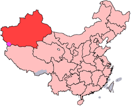
Administration Region: Xinjiang
Population: 37238
ISO2 Code: Xinjiang
ISO3 Code: CHN
Location Type:
Latitude: 43.9771
Longitude: 81.5274
Yining County (Chinese: 伊宁县) as the official romanized name, also transliterated from Uyghur as Gulja County (Uyghur: غۇلجا ناھىيىسى; Chinese: 固勒扎县), is a county within the Ili Kazakh Autonomous Prefecture of the Xinjiang Uyghur Autonomous Region of China. The county seat is in the town of Jélilyüzi (Uyghur: جېلىل يۈزى; 吉里于孜; Jílǐyúzī).
Yining County does not include the adjacent city of Yining, which is a county-level administrative unit in its own right.
The county land area is 4486 km², with the population of 360,000 people as of 2004.A larger area (around 4580 km²) and population (400,000) was reported for the county 2000; this decrease and the corresponding increase of area and population for the City of Yining resulted from the transfer of the villages of Dadamtu (Uyghur: دادامتۇ, Дадамту; 达达木图; Dádámùtú) and Penjim (Uyghur: پەنجىم, Пәнҗим; 潘津; Pānjīn), with 100.45 km2 (38.78 sq mi) of land, from the County to the City in 2004.
Top Jelilyüzi HD Maps, Free Download 🗺️
Map
Maps
United States
United States
World Map
China
China

