Location: Kailahun 🌎

Location: Kailahun, Sierra Leone Administration Region: Eastern Population: 30411 ISO2 Code: Eastern ISO3 Code: SLE Location Type: Latitude: 8.1667 Longitude: -10.75
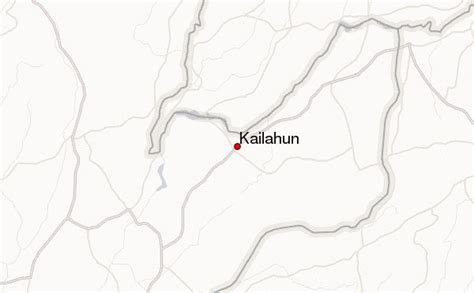
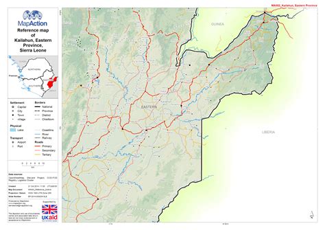
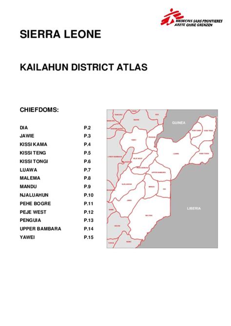
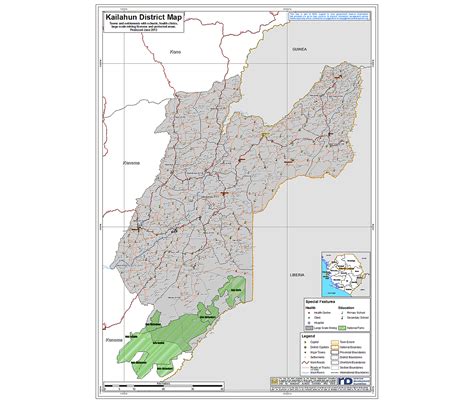
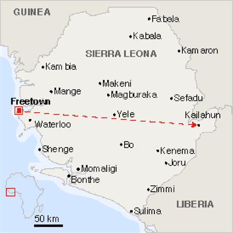
Kailahun District is a district in the Eastern Province of Sierra Leone. Its capital and largest city is the town of Kailahun. The second most populous city in the district is Segbwema. Other major towns in Kailahun District include Koindu, Pendembu and Daru. As of the 2015 census, the district had a population of 525,372. Kailahun District is subdivided into fourteen chiefdoms. The District of Kailahun borders Kenema District to the west, Kono District to the north, the Republic of Liberia to the east, and the Republic of Guinea to the north. The border of the district with Guinea is formed by a section of the Moa River. The total area of the district is 4,859 km2 (1,876 sq mi). The population of Kailahun District is largely from the Mende ethnic group, though there are other ethnic groups with significant population in the district, including among them the Kissi, Mandingo and the Fula. The major economic activities in the district are farming, diamond mining and trade. The large majority of the people of Kailahun District are Muslims, though with a significant Christian minority. Kailahun District is a political stronghold of the Sierra Leone People’s Party (SLPP), the current ruling party in Sierra Leone. Since Sierra Leone”s Independence in 1961 to present, the overwhelming majority of the people of Kailahun Districts support the Sierra Leone People’s Party (SLPP). Kailahun District is the birthplace of former Sierra Leone’s president Ahmad Tejan Kabbah, who was born in the town of Pendembu.
Kailahun Download Free HD Maps, Regions and Roads (Images & PDFs)

Top Kailahun HD Maps, Free Download 🗺️

Map
Maps
United States
United States
World Map
China
China
Kenema Sierra Leone, Sierra Leone Animals, Location , Kailahun, Sierra Leone
850 x 500px
Kailahun, Sierra Leone
Kailahun Location Guide, Kailahun, Sierra Leone, Sierra Leone Civil War, Sierra Leone Scenery
600 x 371px
Kailahun, Sierra Leone
Sierra Leone Road, Sierra Leone Person, Eastern Province, Kailahun, Sierra Leone
3635 x 2571px
Kailahun, Sierra Leone
Sierra Leone Rainforest, Sierra Leone Country, Kailahun District, Kailahun, Sierra Leone
724 x 1024px
Kailahun, Sierra Leone
Sierra Leone District Planning Map – Kailahun – A1 Size | Revenue …, Kailahun, Sierra Leone, Sierra Leone Person, Sierra Leone Rainforest
1204 x 1024px
Kailahun, Sierra Leone
Location Map Of The Falaba District Of Sierra Leone Stock Vector …, Kailahun, Sierra Leone, Sierra Leone Animals, Sierra Leone District
800 x 812px
Kailahun, Sierra Leone
Kailahun District Wiki, Kailahun, Sierra Leone, Sierra Leone Images, Sierra Leone Road
1201 x 1181px
Kailahun, Sierra Leone
Sierra Leone Location, Sierra Leone Civil War, Wikimedia Commons, Kailahun, Sierra Leone
110 x 120px
Kailahun, Sierra Leone
Freetown-Kailahun, Sierra Leona | Internacional | El Pais, Kailahun, Sierra Leone, Sierra Leone Land, Sierra Leone Location
828 x 828px
Kailahun, Sierra Leone