Location: Kaliningrad 🌎
Location: Kaliningrad, Russia
Administration Region: Kaliningradskaya Oblast’
Population: 475056
ISO2 Code: Kaliningradskaya Oblast’
ISO3 Code: RUS
Location Type: First-level Admin Capital
Latitude: 54.7003
Longitude: 20.4531
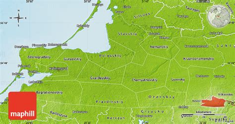
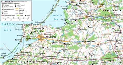
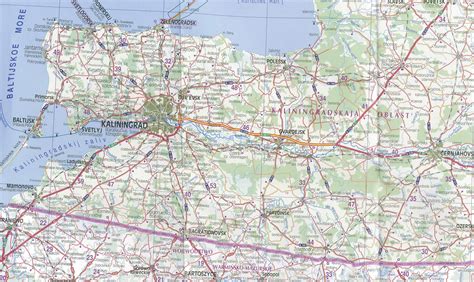
Kaliningrad ( kə-LIN-in-grad; Russian: Калининград, IPA: [kəlʲɪnʲɪnˈɡrat]), until 1946 known as Königsberg (German pronunciation: [ˈkøːnɪçsbɛʁk]; Russian: Кёнигсберг, tr. Kyonigsberg, IPA: [ˈkʲɵnʲɪɡzbɛrk]; Russian: Короле́вец, tr. Korolevets), is the largest city and administrative centre of Kaliningrad Oblast, a Russian semi-exclave between Lithuania and Poland. The city sits about 663 kilometres (412 mi) west from mainland Russia. The city is situated on the Pregolya River, at the head of the Vistula Lagoon on the Baltic Sea, and is the only ice-free port of Russia and the Baltic states on the Baltic Sea. Its population in 2020 was 489,359, with up to 800,000 residents in the urban agglomeration. Kaliningrad is the second-largest city in the Northwestern Federal District, after Saint Petersburg, the third-largest city in the Baltic region, and the seventh-largest city on the Baltic Sea.
The settlement of modern-day Kaliningrad was founded in 1255 on the site of the ancient Old Prussian settlement Twangste by the Teutonic Knights during the Northern Crusades, and was named Königsberg in honor of King Ottokar II of Bohemia. A Baltic port city, it successively became the capital of the State of the Teutonic Order, the Duchy of Prussia (1525–1701) and East Prussia. Königsberg remained the coronation city of the Prussian monarchy, though the capital was moved to Berlin in 1701. From 1454 to 1455 the city under the name of Królewiec belonged to the Kingdom of Poland, and from 1466 to 1657 it was a Polish fief. Königsberg was the easternmost large city in Germany until World War II. The city was heavily damaged by Allied bombing in 1944 and during the Battle of Königsberg in 1945; it was then captured by the Soviet Union on 9 April 1945. The Potsdam Agreement of 1945 placed it under Soviet administration. The city was renamed Kaliningrad in 1946 in honor of Russian Bolshevik leader Mikhail Kalinin. Since the dissolution of the Soviet Union, it has been governed as the administrative centre of Russia’s Kaliningrad Oblast, the westernmost oblast of Russia.As a major transport hub, with sea and river ports, the city is home to the headquarters of the Baltic Fleet of the Russian Navy, and is one of the largest industrial centres in Russia. It was deemed the best city in Russia in 2012, 2013, and 2014 in Kommersant’s magazine The Firm’s Secret, the best city in Russia for business in 2013 according to Forbes, and was ranked fifth in the Urban Environment Quality Index published by Minstroy in 2019. Kaliningrad has been a major internal migration attraction in Russia over the past two decades, and was one of the host cities of the 2018 FIFA World Cup.

Top Kaliningrad HD Maps, Free Download 🗺️
Map
Maps
United States
United States
World Map
China
China


