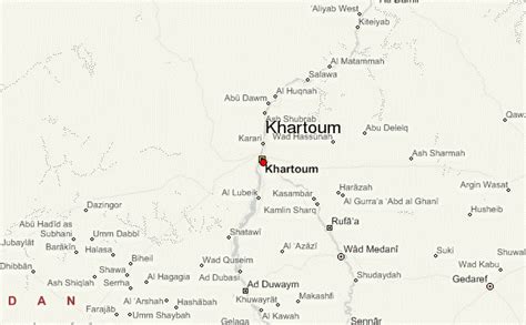
Location: Khartoum North 🌎
Location: Khartoum North, Sudan
Administration Region: Khartoum
Population: 936349
ISO2 Code: Khartoum
ISO3 Code: SDN
Location Type:
Latitude: 15.6
Longitude: 32.5
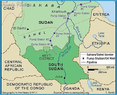
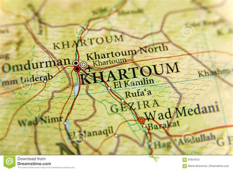
Khartoum or Khartum ( kar-TOOM; Arabic: الخرطوم, romanized: Al-Khurṭūm, pronounced [al.xur.tˤuːm], Dinka: Kaartuɔ̈m) is the capital of Sudan. With a population of 5,274,321, its metropolitan area is the largest in Sudan. It is located at the confluence of the White Nile, flowing north from Lake Victoria, and the Blue Nile, flowing west from Lake Tana in Ethiopia. The place where the two Niles meet is known as al-Mogran or al-Muqran (المقرن; English: “The Confluence”). From there, the Nile continues north towards Egypt and the Mediterranean Sea.
Divided by these two parts of the Nile, Khartoum is a tripartite metropolis with an estimated population of over five million people, consisting of Khartoum proper, and linked by bridges to Khartoum North (الخرطوم بحري al-Kharṭūm Baḥrī) and Omdurman (أم درمان Umm Durmān) to the west.
Khartoum was founded in 1821 as part of Egypt, north of the ancient city of Soba. While the United Kingdom exerted power over Egypt, it left administration of the Sudan to it until Mahdist forces took over Khartoum. The British attempted to evacuate Anglo-Egyptian garrisons from Sudan but the Siege of Khartoum in 1884 resulted in the capture of the city by Mahdist forces and a massacre of the defending Anglo-Egyptian garrison. In 1898 it was reoccupied by British forces, and was the seat of the Anglo-Egyptian Sudan government until 1956.In 1956, the city was designated as the capital of an independent Sudan. Three hostages were killed during the attack on the Saudi Embassy in Khartoum in 1973.
In 2008, the Justice and Equality Movement engaged in combat in the city with the Sudanese Armed Forces as part of the War in Darfur. The Khartoum massacre occurred in 2019 during the Sudanese Revolution. The city saw extensive combat during the 2023 Sudan clashes between the armed forces and the Rapid Support Forces (RSF), affecting Khartoum International Airport and other critical sites.Khartoum is an economic and trade centre in Northern Africa, with rail lines from Port Sudan and El-Obeid. It is served by Khartoum International Airport, and Khartoum New International Airport is under construction. Several national and cultural institutions are in Khartoum and its metropolitan area, including the National Museum of Sudan, the Khalifa House Museum, the University of Khartoum, and the Sudan University of Science and Technology.
Top Khartoum North HD Maps, Free Download 🗺️
Map
Maps
United States
United States
World Map
China
China


