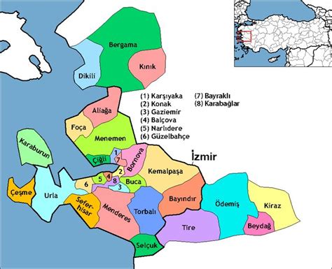
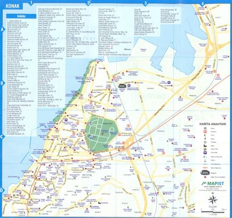
Konak is a district of İzmir Province in Turkey. It is the most densely populated of the eleven main urban districts of İzmir, and has historically acted as the administrative and economic core of the city. Situated in an area that roughly corresponds to the geographic center of İzmir, Konak extends for 11.4 kilometres (7 miles) along the southern coastline of the Gulf of İzmir. A long panhandle that the district area draws in the direction of the southwest, on the other hand, also covers a large rural area, mostly covered with mountains and forests, and two isolated villages. Konak district area neighbors the district areas of Bornova to the east, Balçova to the west and Buca and Gaziemir to the south, all of which are also among İzmir’s metropolitan districts. Konak center is connected to other districts of İzmir and beyond by a dense network of roads and railroads, as well as by a subway line currently being largely extended and by ferry services to Karşıyaka. Konak is a very active hub of industry, trade, commerce and services, with the number of companies exceeding sixty thousand and its exports nearing two billion US Dollars in 2006.