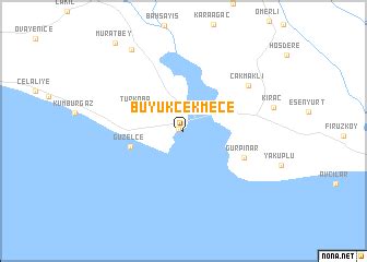
Location: Küçükçekmece 🌎
Location: Küçükçekmece, Turkey
Administration Region: İstanbul
Population: 770317
ISO2 Code: İstanbul
ISO3 Code: TUR
Location Type: Lower-level Admin Capital
Latitude: 41
Longitude: 28.8
Küçükçekmece (pronounced [cyˈtʃyctʃecmedʒe]; meaning “small-drawer”, from much earlier Rhagion and Küçükçökmece as “little breakdown” or “little depression”, in more ancient times just as Bathonea), is a suburb and district of Istanbul, Turkey, 23 kilometers west of the city centre and lying next to Lake Küçükçekmece. Both the lake and land reside on the European shore of the Sea of Marmara.
It is the second most populous district of Istanbul, and has the third most populous sub-district neighborhood in Istanbul, Halkalı-Atakent.

Top Küçükçekmece HD Maps, Free Download 🗺️
Map
Maps
United States
United States
World Map
China
China


