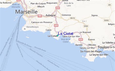
Location: La Ciotat 🌎
Location: La Ciotat, France
Administration Region: Provence-Alpes-Côte d’Azur
Population: 35993
ISO2 Code: Provence-Alpes-Côte d’Azur
ISO3 Code: FRA
Location Type:
Latitude: 43.1769
Longitude: 5.6086
La Ciotat (French: [la sjɔta]; Provençal Occitan: La Ciutat [la sjewˈta]; in Mistralian spelling La Ciéutat; ‘the City’) is a commune in the Bouches-du-Rhône department in the Provence-Alpes-Côte d’Azur region in Southern France. It is the southeasternmost commune of the Aix-Marseille-Provence Metropolis. La Ciotat is located at about 25 km (15.5 mi) to the east of Marseille, at an equal distance from Toulon. In 2018, it had a population of 35,281.

Top La Ciotat HD Maps, Free Download 🗺️
Map
Maps
United States
United States
World Map
China
China
