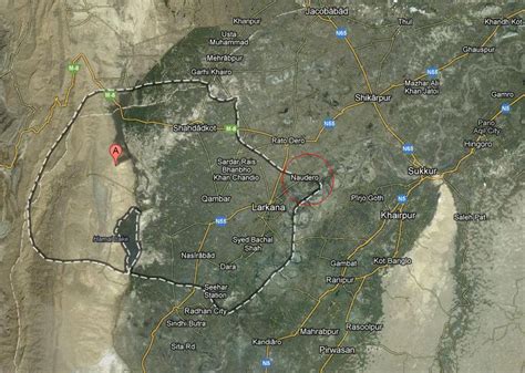
Location: Larkana 🌎
Location: Larkana, Pakistan
Administration Region: Sindh
Population: 490508
ISO2 Code: Sindh
ISO3 Code: PAK
Location Type: Lower-level Admin Capital
Latitude: 27.5583
Longitude: 68.2111
Larkana (Sindhi: لاڙڪاڻو, romanized: lāṛkāṇo; Urdu: لاڑکانہ, romanized: lāṛkāna) is a city located in the Sind province of Pakistan. It is the 15th largest city of Pakistan by population. It is home to the Indus Valley civilization site Mohenjo-daro. The historic Indus River flows in east and south of the city.The city is located within Larkana District. Formerly known as “Chandka”, Larkana is located on the south bank of the Ghar canal, about 40 miles (64 km) south of the town Shikarpur, and 36 miles (58 km) northeast of Mehar. According to the 2017 Census of Pakistan, its population is 490,508. Therefore, it is the fourth most populated city of Sindh province after Karachi, Hyderabad, and Sukkur. Moreover, Larkana city has been placed as fifteenth largest of Pakistan during Census 2017.

Top Larkana HD Maps, Free Download 🗺️
Map
Maps
United States
United States
World Map
China
China
