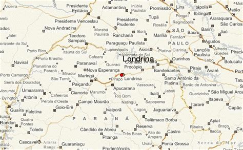
Location: Londrina 🌎
Location: Londrina, Brazil
Administration Region: Paraná
Population: 548249
ISO2 Code: Paraná
ISO3 Code: BRA
Location Type:
Latitude: -23.31
Longitude: -51.1628
Londrina (Portuguese pronunciation: [lõˈdɾĩnɐ], literally “Little London”) is a city located in the north of the state of Paraná, South Region, Brazil, and is 369 km (229 miles) away from the state capital, Curitiba. It is the second largest city in the state and fourth largest in the southern region of the country, with 588,125 inhabitants in the city proper (2022) It has a Human Development Index of 0.778.
Londrina was originally explored by British settlers, and then officially established in 1930 by a small group of Italian, Japanese and German settlers. It rapidly became the commercial, political, and cultural centre of the state’s northern pioneer zone. Its universities include the Universidade Estadual de Londrina (Londrina State University) and the Universidade Tecnológica Federal do Paraná (Federal University of Technology – Paraná).
Top Londrina HD Maps, Free Download 🗺️
Map
Maps
United States
United States
World Map
China
China

