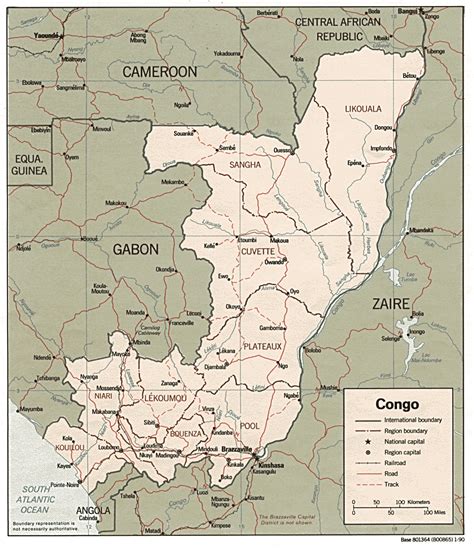
The Republic of the Congo (French: République du Congo, Lingala: Republíki ya Kongó), also known as Congo-Brazzaville, the Congo Republic or simply either Congo or the Congo, is a country located on the western coast of Central Africa to the west of the Congo River. It is bordered to the west by Gabon, to its northwest by Cameroon and its northeast by the Central African Republic, to the southeast by the Democratic Republic of the Congo, to its south by the Angolan exclave of Cabinda and to its southwest by the Atlantic Ocean.
The region was dominated by Bantu-speaking tribes at least 3,000 years ago, who built trade links leading into the Congo River basin. Congo was formerly part of the French colony of Equatorial Africa. The Republic of the Congo was established on 28 November 1958 and gained independence from France in 1960. It was a Marxist–Leninist state from 1969 to 1992, under the name People’s Republic of the Congo. The country has had multi-party elections since 1992, but a democratically elected government was ousted in the 1997 Republic of the Congo Civil War. President Denis Sassou Nguesso who first came to power in 1979 ruled until 1992 and then again from 1997 onwards.
It is a member of the African Union, the United Nations, La Francophonie, the Economic Community of Central African States, and the Non-Aligned Movement. It has become the 4th-largest oil producer in the Gulf of Guinea, providing the country with a degree of prosperity, with political and economic instability in some areas and unequal distribution of oil revenue nationwide. Its economy is dependent on the oil sector, and economic growth has slowed since the post-2015 drop in oil prices. With a population of 5.2 million, 88.5% of the country practices Christianity.