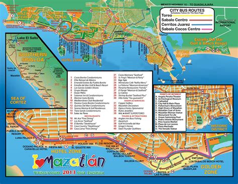
Location: Mazatlán 🌎
Location: Mazatlán, Mexico
Administration Region: Sinaloa
Population: 658354
ISO2 Code: Sinaloa
ISO3 Code: MEX
Location Type: Lower-level Admin Capital
Latitude: 23.2167
Longitude: -106.4167
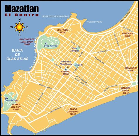
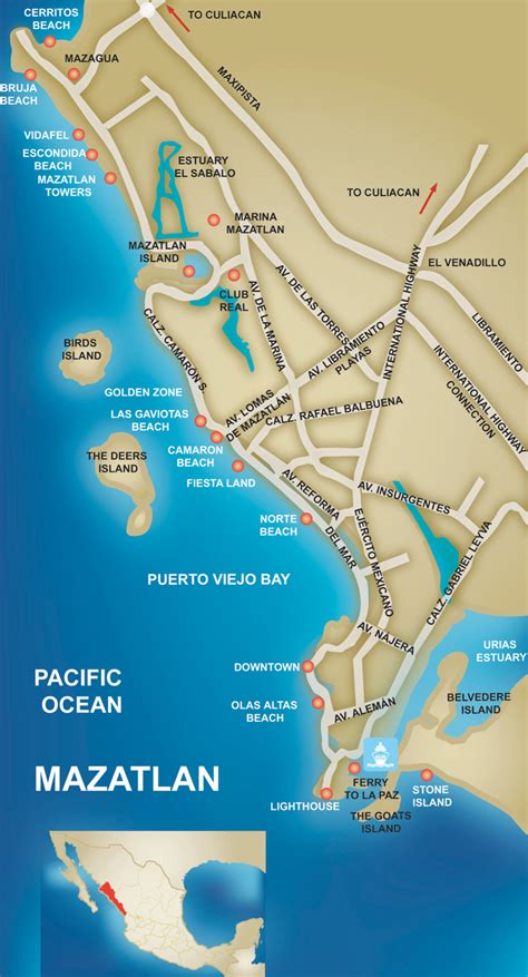
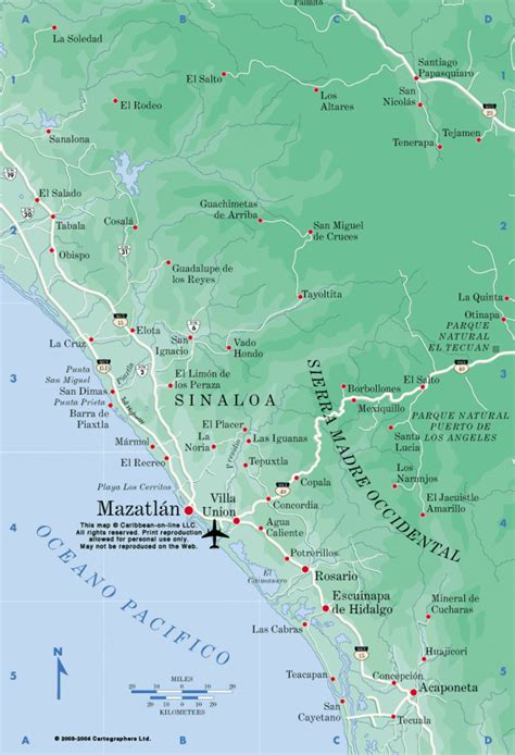
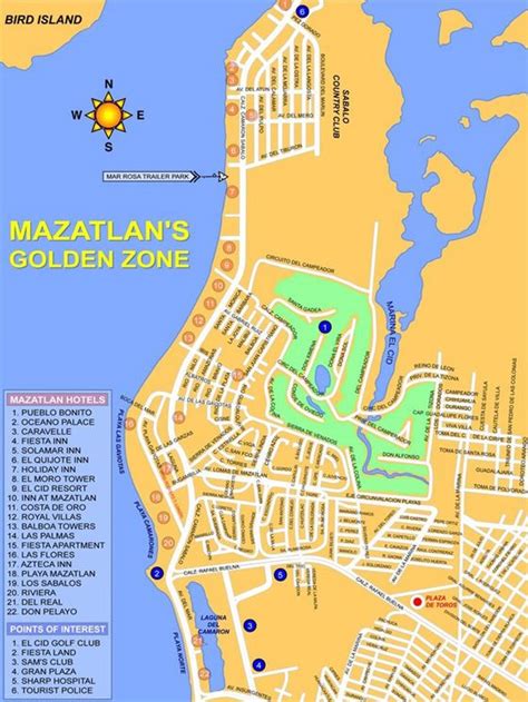
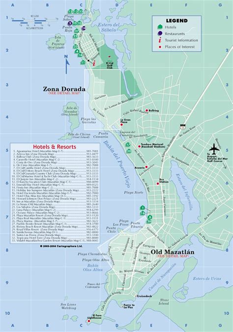
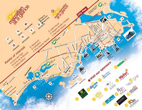
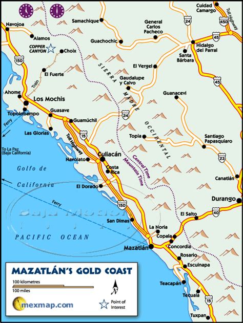
Mazatlán (Spanish pronunciation: [masaˈtlan] ) is a city in the Mexican state of Sinaloa. The city serves as the municipal seat for the surrounding municipio, known as the Mazatlán Municipality. It is located on the Pacific coast, across from the southernmost tip of the Baja California Peninsula.
Mazatlán is a Nahuatl word meaning “place of deer”. The city was colonized in 1531 by an army of Spaniards and indigenous people. By the mid-19th century, a large group of immigrants arrived from Germany. Over time, Mazatlán developed into a commercial seaport, importing equipment for the nearby gold and silver mines. It served as the capital of Sinaloa from 1859 to 1873. The German settlers also influenced the local music, banda, with some genres being an alteration of Bavarian folk music. The settlers also established the Pacifico Brewery on March 14, 1900. Mazatlán has a rich culture and art community. In addition to the Angela Peralta Theater, Mazatlán has many galleries and artist’s studios. Mazatlán’s art museum, the Museo del Arte, exhibits both Mexican and international artists.
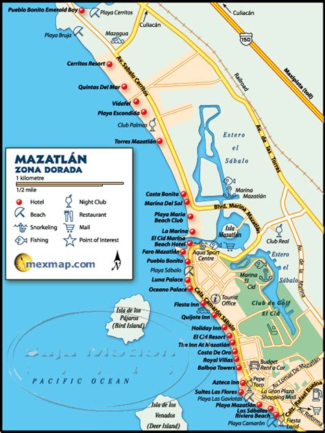
With a population of 438,434 (city) and 489,987 (municipality) as of the 2010 census, Mazatlán is the second-largest city in the state. It is also a tourist destination, with its beaches lined with resort hotels. A car ferry crosses the Gulf of California, from Mazatlán to La Paz, Baja California Sur. The municipality has a land area of 3,068.48 km2 (1,184.75 sq mi) and includes smaller outlying communities such as Villa Unión, La Noria, El Quelite, and El Habal. Mazatlán is served by General Rafael Buelna International Airport.
Top Mazatlán HD Maps, Free Download 🗺️
Map
Maps
United States
United States
World Map
China
China
