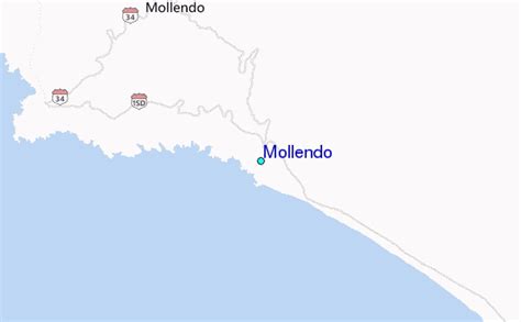
Location: Mollendo 🌎
Location: Mollendo, Peru
Administration Region: Arequipa
Population: 28305
ISO2 Code: Arequipa
ISO3 Code: PER
Location Type:
Latitude: -17.0231
Longitude: -72.0147
Mollendo is a town bordering the Pacific Ocean in southern Peru. It is located in the Arequipa Region and is the capital of both the Islay Province and the Mollendo District. Mollendo was the main port in the Peruvian southern coast until Matarani was developed about 50 years ago; the port of Mollendo only serves fishermen for the local economy currently and all the commercial shipping is done through Matarani 12 kilometers north; the old port is in ruins. From about 1830 to 1880 it was important in the Guano trade.
The railroad used to run a passenger train daily, but a good highway connects Mollendo to the Panamerican Highway now and the train now only runs the summer express that goes down from Arequipa on Saturday and returns on Sunday; the beach is the main attraction, even though it is visited by the Humboldt Current that brings cold water from Antarctica. In the summer months, which run from December to April, the population more than doubles as people from the largest city in the region Arequipa use Mollendo and its beaches as a vacation spot, especially on weekends. Mollendo exports wool and has industries producing cement, textiles, canned fish, and cheese. It is also a popular beach resort. The Auxiliary Ship BAP Mollendo (ATC-131) of the Peruvian Navy is named after the town.
Top Mollendo HD Maps, Free Download 🗺️
Map
Maps
United States
United States
World Map
China
China
