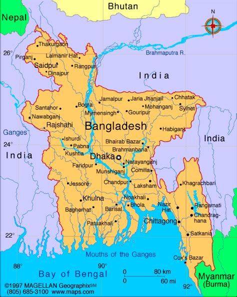
Mymensingh (Bengali: ময়মনসিংহ) is the capital of Mymensingh Division, Bangladesh. Located on the bank of Brahmaputra River, about 120 km (75 mi) north of the national capital Dhaka, it is a major financial center and educational hub of north-central Bangladesh. The city was constituted by the British East India Company on 1 May 1787, Mymensingh had the largest economy in the nation until Mohokuma Tangail rebelled and took over more than one-third of its land to form a district during Pakistan era.Mymensingh is the 8th administrative divisional headquarter and 12th city corporation of Bangladesh. According to Ministry of Public Administration, Mymensingh is ranked 4th in district status. The population density of Mymensingh city is 44,458/km2 (115,150/sq mi), making it the second most densely populated city in Bangladesh. Mymensingh attracts 25 percent of all the health tourists visiting Bangladesh. Mymensingh is an anglicisation of the name Momen Singh, referring to a Muslim ruler called Shah Momin or Momin Singh, an ethnic Bengali Muslim ruler. Its elevation is over 19 m above sea level, the highest of Bangladesh’s major cities. Mymensingh is close to Tura, a city in Meghalaya from the Gobrakura Land Port.
Mymensingh is associated with the Brahmaputra river, handcrafted duvets called Nakshikantha (Bengali: নকশীকাঁথা), and a rural ballad called Maimansingha Gitika. The cadet college established in Tangail in 1963 was called Momenshahi Cadet College. The city is known for educational institutions.