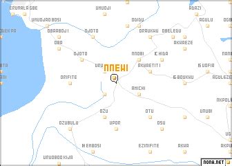
Nnewi is a commercial and industrial city in Anambra State, southeastern Nigeria. It is the second largest city in Anambra state after Onitsha . Nnewi as a metropolitan area has two local government area, which are Nnewi North and Nnewi South. Even Ekwusigo local government area is now part of Nnewi urban area, as urbanization continues to spread from Nnewi to neighbouring communities . Nnewi North comprises four quarters: Otolo, Uruagu, Umudim, and Nnewichi. The first indigenous car manufacturing plant in Nigeria is located in the city while the first wholly Made-in-Nigeria motorcycle, the ‘NASENI M1’ was manufactured in Nnewi.As of 2006, Nnewi has an estimated population of 391,227 according to the Nigerian census. The 2019 population estimate shows that Nnewi has a population of over 900,000 people. The city spans over 200 square miles (520 km2) in Anambra State. Nnewi Metropolitan Area and its satellite towns is home to nearly 2.5 million residents As of 2005. Dimensionally, Nnewi has an edge over all other units, it was recognized by the 1953 census figures as the largest inland town of all others in the Eastern states of Nigeria.Projected to be the twelfth fastest growing city on the African continent between 2020 and 2025, with a 5.18% growth.