Location: Olopa 🌎

Location: Olopa, Guatemala Administration Region: Chiquimula Population: 30534 ISO2 Code: Chiquimula ISO3 Code: GTM Location Type: Lower-level Admin Capital Latitude: 14.6833 Longitude: -89.35
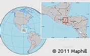
Olopa is a municipality in the Chiquimula department of Guatemala. The municipality comprises an area of 112 km2, distributed in 1 town (Olopa) and 29 villages, with a total population of 27,511.It is bordered on the north by the municipality of Jocotán, on the south and east by Esquipulas, and on the west by Quezaltepeque and San Juan Hermitage. It has a subtropical highland climate (Köppen: Cwb).
Olopa Download Free HD Maps, Regions and Roads (Images & PDFs)

Top Olopa HD Maps, Free Download 🗺️

Map
Maps
United States
United States
World Map
China
China
Olopa, Chiquimula, Guatemala: Location Maps, Olopa, Guatemala, Guatemala Capital, Guatemala Rivers
178 x 110px
Guatemala, Olopa