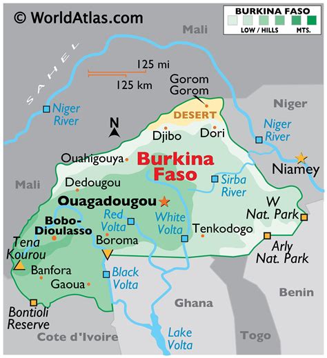
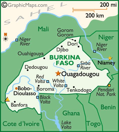
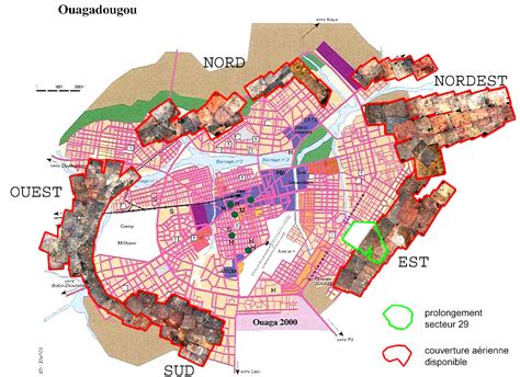
Ouagadougou ( WAH-gə-DOO-goo, Mossi: [ˈwɔɣədəɣʊ], French: [waɡaduɡu]) is the capital of Burkina Faso and the administrative, communications, cultural, and economic centre of the nation. It is also the country’s largest city, with a population of 2,415,266 in 2019. The city’s name is often shortened to Ouaga. The inhabitants are called ouagalais. The spelling of the name Ouagadougou is derived from the French orthography common in former French African colonies.
Ouagadougou’s primary industries are food processing and textiles. It is served by an international airport and is linked by rail to Abidjan in the Ivory Coast and, for freight only, to Kaya. There are several highways linking the city to Niamey, Niger, south to Ghana, and southwest to Ivory Coast. Ouagadougou has one of West Africa’s largest markets, which burned down in 2003 and has since reopened with better facilities and improved fire-prevention measures. Other attractions include the National Museum of Burkina Faso, the Moro-Naba Palace (site of the Moro-Naba Ceremony), the National Museum of Music, and several craft markets.