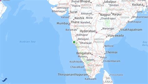
Location: Panaji 🌎
Location: Panaji, India
Administration Region: Goa
Population: 40017
ISO2 Code: Goa
ISO3 Code: IND
Location Type: First-level Admin Capital
Latitude: 15.4989
Longitude: 73.8278
Panaji (; Goan Konkani: Ponnjem; also known as Panjim) is the capital of the Indian state of Goa and the headquarters of North Goa district. Previously, it was the territorial capital of the former Portuguese India. It lies on the banks of the Mandovi river estuary in the Tiswadi sub-district (taluka). With a population of 114,759 in the metropolitan area, Panaji is Goa’s largest urban agglomeration, ahead of Margao and Mormugao.
Panaji has terraced hills, concrete buildings with balconies and red-tiled roofs, churches, and a riverside promenade. There are avenues lined with gulmohar, acacia and other trees. The baroque Our Lady of the Immaculate Conception Church is located overlooking the main square known as Praça da Igreja. Panaji has been selected as one of hundred Indian cities to be developed as a smart city under the Smart Cities Mission.
The city was built with stepped streets and a seven kilometre long promenade on a planned grid system after the Portuguese relocated the capital from Velha Goa in the 17th century. It was elevated from a town to a city on 22 March 1843.

Top Panaji HD Maps, Free Download 🗺️
Map
Maps
United States
United States
World Map
China
China