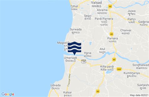
Pardi is a town and a municipality in Valsad district in the Indian state of Gujarat. Historically, there is a Hill in the middle of the town facing the lake where it is said Shivaji built the Killa (Fort). It’s from this Killa (Fort) that the town is also called Killa-Pardi. Roughly 14 km south of the district headquarters city of Valsad, Pardi has a rail station on the Mumbai-Vadodara line of Western Railway (India). National Highway 8 bisects the town in east and west regions. The town has a municipality office and a court. The town centre also known for the Bus Stop at the intersection of Roads from Chival (East), Umarsadi (West), Damni Zampa (South) and Valsadi Zampa (North). Pardi has a wonderful lake called Talav spread over 99 acres which is proposed to be made tourist place in the near future.The city of Vapi, a large industrial township for small-scale industries, Roughly 14 km south of Pardi town. Pardi has its own industrial zone which is governed by GIDC and caters mainly to the Textile industry.
Udvada, the holy town for Parsis, is about 7 km south of Pardi town.
Daman & Dadra Nagar Haveli, a famous tourist destination, is about 16 km south of Pardi town.