Location: Piraeus 🌎
Location: Piraeus, Greece
Administration Region: Attikí
Population: 448997
ISO2 Code: Attikí
ISO3 Code: GRC
Location Type: Lower-level Admin Capital
Latitude: 37.943
Longitude: 23.6469
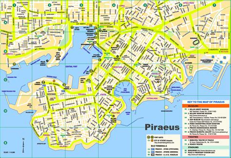
Piraeus ( py-REE-əs, pirr-AY-əs; Greek: Πειραιάς Peiraiás [pireˈas]; Ancient Greek and Katharevousa: Πειραιεύς Peiraieús; Ancient: [peːrai̯eús], Katharevousa: [pire̞ˈefs]) is a port city within the Athens urban area (“Greater Athens”), in the Attica region of Greece. It is located eight kilometres (5 mi) southwest of Athens’ city centre, along the east coast of the Saronic Gulf in the Athens Riviera.
The municipality of Piraeus and four other suburban municipalities form the regional unit of Piraeus, sometimes called the Greater Piraeus area, with a total population of 448,997. At the 2011 census, Piraeus had a population of 163,688 people, making it the fifth largest municipality in Greece and the second largest (after the municipality of Athens) within the Athens urban area.
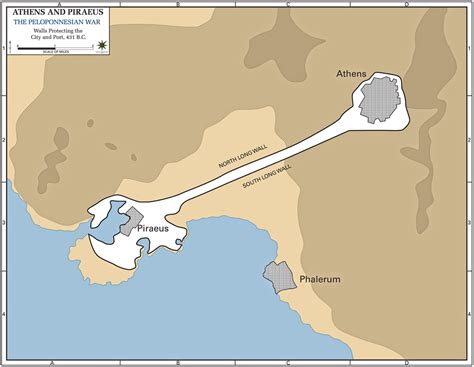
Piraeus has a long recorded history, dating back to ancient Greece. The city was founded in the early 5th century BC, when plans to make it the new port of Athens were implemented: A prototype harbour was constructed, which resulted in concentrating in one location all the import and transit trade of Athens, along with the navy’s base. During the Golden Age of Athens, the Long Walls were constructed to fortify the route from the main settlement to the port (Piraeus). During the classical period, the naval base in Piraeus had 372 trireme shipsheds. Beginning in the 3rd century B.C., Piraeus went into a period of cumulative decline. However, it began growing once again in the 19th century, after Athens was made the capital of Greece. Today, Piraeus is a large city, bustling with activity, and an integral part of Athens. It is a huge marine and commercial-industrial centre, and home to Greece’s largest harbour.
The port of Piraeus is the chief port in Greece, the 5th largest passenger port in Europe and the 24th largest passenger port in the world serving about 4,37 million passengers annually in 2020. With a throughput of 5.44 million TEUs, Piraeus is among the busiest ten ports in Europe in terms of container traffic, and is the busiest container port in the Eastern Mediterranean. The municipality hosted events in both the 1896 and 2004 Summer Olympics held in Athens. The University of Piraeus is one of the largest universities in Greece, and includes the country’s second-oldest business school, as well as the oldest academic department dedicated to the study of finance.
Top Piraeus HD Maps, Free Download 🗺️
Map
Maps
United States
United States
World Map
China
China


