Ramsar (Persian: رامسر, also Romanized as Rámsar and Ránsar; formerly, Sakht Sar) is the capital of Ramsar County, Mazandaran Province, Iran. In 2012 its population was 33,018, in 9,421 families.
Ramsar lies on the coast of the Caspian Sea. It was also known as Sakhtsar in the past. The climate of Ramsar is hot and humid in summer and mild in winter. The proximity of the forest and the sea in this city has given a special beauty to this city and this attracts tourists in all seasons. Ramsar has an airport. The city of Ramsar was a small village in western Mazandaran until the Qajar period, and during the first Pahlavi period, with the rule of Reza Shah and with the support of the government, it became a beautiful city with many tourist facilities.
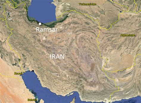
Ramsar is the westernmost county and city in Mazandaran. It borders the Caspian Sea to the north, Gilan province to the west, Qazvin Province to the south, and Tonekabon to the east.