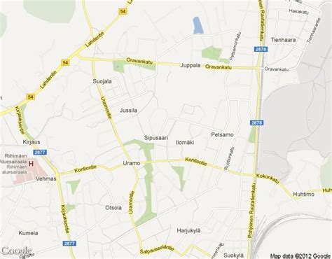
Location: Riihimäki 🌎
Location: Riihimäki, Finland
Administration Region: Kanta-Häme
Population: 29269
ISO2 Code: Kanta-Häme
ISO3 Code: FIN
Location Type: Lower-level Admin Capital
Latitude: 60.7333
Longitude: 24.7667
Riihimäki (literally “Drying barn hill”) is a town and municipality in the south of Finland, about 69 kilometres (43 mi) north of Helsinki and 109 kilometres (68 miles) southeast of Tampere. An important railway junction is located in Riihimäki, since railway tracks from Riihimäki lead to Helsinki, Tampere and Lahti.
Several businesses also operate in Riihimäki. Notably, Würth Oy has its Finnish headquarters and logistics center in Riihimäki. Valio has a major dairy in the Herajoki part of Riihimäki. The famous Sako rifles are also produced in Riihimäki. Riihimäki also has the second-highest flagpole in Finland.
The town is located in the province of Southern Finland and is part of the Tavastia Proper region. The town has a population of 28,350 (28 February 2023) and covers an area of 125.56 square kilometres (48.48 sq mi) of which 4.54 km2 (1.75 sq mi) is water. The population density is 234.26 inhabitants per square kilometre (606.7/sq mi). The municipality is unilingually Finnish.
Riihimäki is home to the Riihimäki Prison, which is, alongside Turku Prison, one of the prisons in the country with the highest security rating (A+), and is home to the country’s most dangerous prisoners.

Top Riihimäki HD Maps, Free Download 🗺️
Map
Maps
United States
United States
World Map
China
China