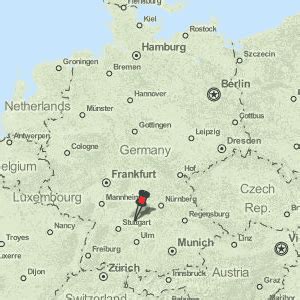
Location: Schwäbisch Hall 🌎
Location: Schwäbisch Hall, Germany
Administration Region: Baden-Württemberg
Population: 41141
ISO2 Code: Baden-Württemberg
ISO3 Code: DEU
Location Type: Lower-level Admin Capital
Latitude: 49.1122
Longitude: 9.7375
Schwäbisch Hall (German pronunciation: [ˈʃvɛːbɪʃ ˈhal]; “Swabian Hall”; from 1802 until 1934 and colloquially: Hall ) is a city in the German state of Baden-Württemberg located in the valley of the Kocher river, the longest tributary (together with its headwater Lein) of the Neckar river. The closest larger city is Heilbronn, and Schwäbisch Hall lies north-east of the state capital of Stuttgart. It is the seat of the district (Landkreis) of Schwäbisch Hall.
Unlike its name might suggest, and unlike Schwäbisch Gmünd, Schwäbisch Hall lies in the region of Heilbronn-Franconia, the East Franconian-speaking northeasternmost part of Baden-Württemberg, which is culturally and linguistically more closely related to the adjoining region of Franconia in neighbouring Bavaria than to the Alemannic-speaking regions of Württemberg, Baden, Switzerland, Bavarian Swabia, Vorarlberg, Alsace and Liechtenstein.
The city’s main landmarks are the market square with St Michael’s Church (St. Michaelskirche), Comburg Castle (a former Benedictine monastery) with St Nicholas’ Church (St. Nikolaus und St. Maria), and the Hallian-Franconian Museum (Hällisch-Fränkisches Museum), dedicated to the art and history of Schwäbisch Hall and surrounding Heilbronn-Franconia.
Schwäbisch Hall was a Free Imperial City within the Holy Roman Empire for five centuries until it was annexed by Württemberg in 1802.

Top Schwäbisch Hall HD Maps, Free Download 🗺️
Map
Maps
United States
United States
World Map
China
China