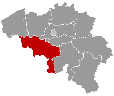
Soignies (French pronunciation: [swaɲi] ; Dutch: Zinnik, pronounced [ˈzɪnɪk]; Picard: Sougniye; Walloon: Sougniye) is a municipality of Wallonia located in the province of Hainaut, Belgium.
It consists of the following districts: Casteau, Chaussée-Notre-Dame-Louvignies, Horrues, Naast, Neufvilles, Soignies and Thieusies. Casteau is known worldwide because SHAPE, the military headquarters of NATO, has been based at the village since 1967.
The name of Soignies comes from the Latin word suniacum, which means “on the Senne”. The spring of the Senne is near Soignies. After Soignies, the river flows through Brussels.
Soignies is also well known for its blue limestone (from the Carrières du Hainaut) and its glass industry (Durobor).