Location: Surakarta 🌎
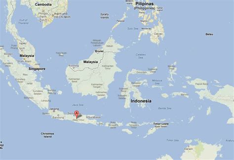
Location: Surakarta, Indonesia
Administration Region: Jawa Tengah
Population: 552118
ISO2 Code: Jawa Tengah
ISO3 Code: IDN
Location Type:
Latitude: -7.5667
Longitude: 110.8167
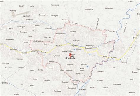
Surakarta (Javanese: ꦯꦸꦫꦏꦂꦠ, Pegon: سوراكارتا), known colloquially as Solo (Javanese: ꦱꦭ; Sálá), is a city in Central Java, Indonesia. The 44 km2 (16.2 sq mi) city adjoins Karanganyar Regency and Boyolali Regency to the north, Karanganyar Regency and Sukoharjo Regency to the east and west, and Sukoharjo Regency to the south. On the eastern side of Solo lies Solo River (Bengawan Solo). Its built-up area, consisting of Surakarta City and 59 districts spread over seven regencies (“Greater Solo Area”, formerly Special Region of Surakarta), was home to 3,649,254 inhabitants as of 2010 census, around half million of which reside in the city proper.
Surakarta is the birthplace of the current President of Indonesia, Joko Widodo. He served as Mayor of Surakarta from 2005 to 2012.

Top Surakarta HD Maps, Free Download 🗺️
Map
Maps
United States
United States
World Map
China
China


