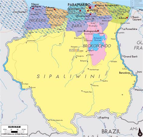
Location: Suriname 🌎
Country: Suriname
ISO2 Code: SR
ISO3 Code: SUR
Location Type: Country
Latitude:
Longitude:
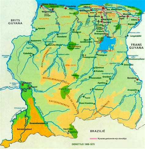
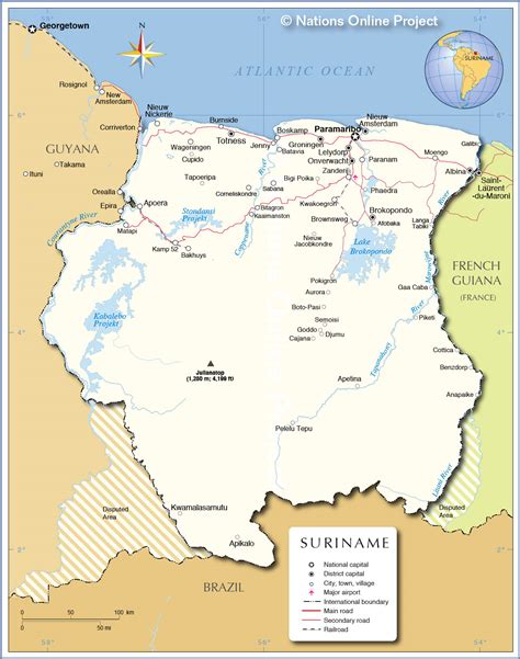
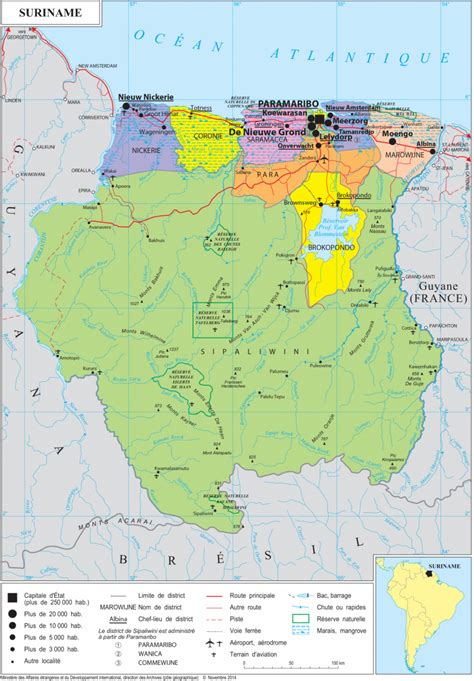
Suriname ( ), officially the Republic of Suriname (Dutch: Republiek Suriname [reːpyˌblik ˌsyːriˈnaːmə]), is a country in northern South America. It is bordered by the Atlantic Ocean to the north, French Guiana to the east, Guyana to the west, and Brazil to the south. At just under 165,000 square kilometers (64,000 square miles), it is the smallest sovereign state in South America.It has a population of approximately 612,985, dominated by descendants from the slaves and labourers brought in from Africa and Asia by the Dutch Empire and Republic.
Most of the people live by the country’s (north) coast, in and around its capital and largest city, Paramaribo. It is also one of the least densely populated countries on Earth. Situated slightly north of the equator, Suriname is a tropical country covered in rainforests. Its extensive tree cover is vital to the country’s efforts to mitigate climate change and maintain carbon negativity. A developing country with a relatively high level of human development, Suriname’s economy is heavily dependent on its abundant natural resources, namely bauxite, gold, petroleum, and agricultural products.
Suriname was inhabited as early as the fourth millennium BC by various indigenous peoples, including the Arawaks, Caribs, and Wayana. Europeans arrived in the 16th century, with the Dutch establishing control over much of the country’s current territory by the late 17th century. During the Dutch colonial period, Suriname was a lucrative source of sugar, its plantation economy driven by African slave labour, and after abolition of slavery in 1863, by indentured servants from Asia, predominantly from British India, as well as the Dutch East Indies. In 1954, Suriname became one of the constituent countries of the Kingdom of the Netherlands. On 25 November 1975, it left the Kingdom to become an independent state. In contrast to Indonesia’s earlier war for independence from the Netherlands, the path toward Suriname’s independence was an initiative of the then left-wing Dutch government. Suriname continues to maintain close diplomatic, economic, and cultural ties with the Netherlands.
Suriname is considered a culturally Caribbean country, and is a member of the Caribbean Community (CARICOM). It is the only sovereign nation outside of Europe where Dutch is the official and prevailing language of government, business, media, and education. According to research by the Dutch Language Union, Dutch is the native language of 60% of Surinamese. Sranan Tongo, an English-based creole language, is a widely used lingua franca.
Suriname is part of several major international and intergovernmental institutions or groupings including the United Nations and the Organisation of Islamic Cooperation.

Top Suriname HD Maps, Free Download 🗺️
Map
Maps
United States
United States
World Map
China
China

