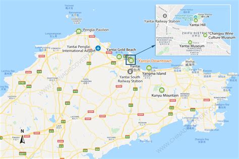
Location: Yantai 🌎
Location: Yantai, China
Administration Region: Shandong
Population: 2511053
ISO2 Code: Shandong
ISO3 Code: CHN
Location Type:
Latitude: 37.4646
Longitude: 121.4478
Yantai, formerly known as Chefoo, is a coastal prefecture-level city on the Shandong Peninsula in northeastern Shandong province of People’s Republic of China. Lying on the southern coast of the Bohai Strait, Yantai borders Qingdao on the southwest and Weihai on the east, with sea access to both the Bohai Sea (via the Laizhou Bay and the Bohai Strait) and the Yellow Sea (from both north and south sides of the Shandong Peninsula). It is the largest fishing seaport in Shandong. Its population was 6,968,202 during the 2010 census, of whom 2,227,733 lived in the built-up area made up of the 4 urban districts of Zhifu, Muping, Fushan and Laishan.

Top Yantai HD Maps, Free Download 🗺️
Map
Maps
United States
United States
World Map
China
China


