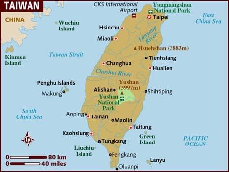
Location: Zhongli 
Location: Zhongli, Taiwan
Administration Region: Taoyuan
Population: 1632616
ISO2 Code: Taoyuan
ISO3 Code: TWN
Location Type:
Latitude: 24.9569
Longitude: 121.2236
Zhongli District (Chinese: 中壢區; pinyin: Zhōnglì Qū) is a district in Taoyuan City, Taiwan. Zhongli is spelled variously as Jungli, Jongli, Jhongli or Chungli on railway stations, bus stops and road signs. Historically, the city is the site of the Zhongli Incident of 1977, the most significant event of the democratization movement prior to the 1980s. Ethnically, it is considered a capital city for Hakka Taiwanese, who live in great numbers here and in surrounding areas; many elderly persons can speak Hakka in addition to Mandarin and Taiwanese Hokkien. In recent years many foreign workers (mainly from the Philippines and Thailand) have also settled in and around the city due to the heavy industry in the suburbs of the city, making it a center for foreign laborers. The district of Zhongli has three large parks and over 70 green reserves.
Zhongli District is the busiest district in Southern Taoyuan (南桃園), as well as the location of the Taoyuan HSR station.
Top Zhongli HD Maps, Free Download 
Map
Maps
United States
United States
World Map
China
China


