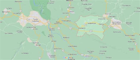
Location: Zinacantán 🌎
Location: Zinacantán, Mexico
Administration Region: Chiapas
Population: 36489
ISO2 Code: Chiapas
ISO3 Code: MEX
Location Type: Lower-level Admin Capital
Latitude: 16.75
Longitude: -92.7
San Lorenzo Zinacantán ( ) is a town in the southern part of the Central Chiapas highlands in the Mexican state of Zinacantán Municipality, Chiapas. 99.1% of its population is Tzotzil Maya, an indigenous people with linguistic and cultural ties to other highland Maya peoples.Zinacantán literally means “land of bats” and comes from the Nahuatl language. People in Zinacantán speak Tzotzil (a Mayan language) and they call their own land “Sots’leb”, that is, “land of bats” in their own language.
Top Zinacantán HD Maps, Free Download 🗺️
Map
Maps
United States
United States
World Map
China
China
